


- You are here:
-
Home

- Scientific Research
Datalogger for Oedometers
- Details
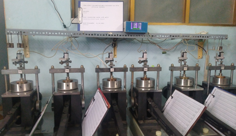
After a four-month-trial period, flatGEO has finished a datalogger system for consolidation tests on oedometer systems made by Nanjing Soil Instrument company in China.
 After a four-month-trial period, flatGEO has finished a datalogger system for consolidation tests on oedometer systems made by Nanjing Soil Instrument company in China.
The flatGEO-datalogger system uses displacement transducers produced by Novotechnik (Germany) with following technical specifications:
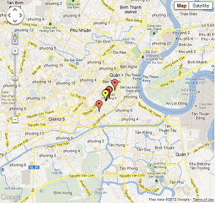
Inventory Map of Geotechnical Investigation Points
- Details
flatGEO Consulting Co. is implementing an inventory map of geotechnical investigation points using Google Maps service. This map will facilitate the data query and the data availability for a proposed investigation site.
All data points on this map are used the coordinate system of WGS84 with UTM projection. Data points using another coordinate system should be transformed to the WGS84/UTM system.
Click here to view the inventory map.
Research Activities
- Details
|
Not only doing business to satisfy the demand of geotechnical investigation for the construction works, but flatGEO Consulting Co., Ltd. also pays attention to the research activities. |
Some major research topics are:
|
1. Set up a geotechnical database of Hochiminh city |
 |
|
2. Application of geostatistics for geotechnical and hydrogeological properties |
 |
|
3. Application 3D modelling for geotechnical properties |
 |
Three-dimensional geological structures at District 1, Saigon
- Details
In 2011, Nguyễn Thanh Danh (The Central University of Construction, Phú Yên province) successfully defended his Master of Science thesis in Geological Engineering with the topic "Application of Geostatistics for Geological Structure Modelling at District 1, Ho Chi Minh City".
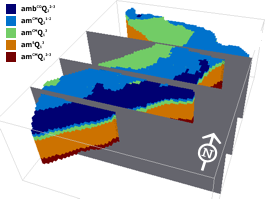
MSc.Nguyễn Thanh Danh cooperated with flatGEO Consulting Co., Ltd. to apply geostatistics, especially, Kriging methods to interpolate continuous surfaces of geotechnical units using an open-source software SGeMS (Stanford Geostatistical Modelling Software) to set up a 3D model for geological structures at District 1, Ho Chi Minh city.
This approach could be applied for other districts at Ho Chi Minh city or other provinces.
 |
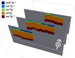 |
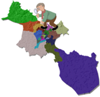
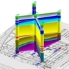
| 3D model for geological structure at Dist.1, HCMC | Some vertical cros-sections at the east-west direction |
Landslide Susceptibility Mapping Using Bayesian Conditional Probability
- Details
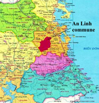
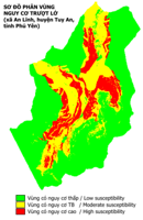
In 2011, Nguyễn Thanh Sơn (Tuy Hoa Industrial College, Phu Yen province) successfully defended his Master of Science thesis in Gelogical Engineering with the topic "Evaluation of Rock Slope Stability and Landslide Susceptibility Mapping for An Linh Commune, Tuy An District, Phu Yen Province".
MSc. Nguyễn Thanh Sơn cooperated with flatGEOConsulting Co., Ltd. in order to apply Bayesian conditional probability method together with GIS tools for landslide susceptibility mapping for An Linh commune, Tuy An district, Phu Yen province.
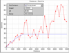
Map of landslide susceptibility is presented in figures below.
 |
 |
| Location of An Linh commune | Landslide susceptibility map |